


Sunken Sanctuary and Settlement Rediscovered on German Coast
A sacred coastal building was drowned and lost during a storm surge in 1362 AD. Now, archaeologists in Germany have rediscovered the sunken medieval structure, which some media outlets are calling “ Germany’s Atlantis”.
The team of archaeologists focused their research on a patch of land that was reclaimed by the sea during a violent sea surge in 1362 AD. The find zone is within the UNESCO Wadden Sea World Heritage Site, which encompasses around 10,000 square kilometers (6,214 sq mi) of the coasts of Denmark, Germany, and the Netherlands.
The team comprised researchers from Kiel University (CAU), Johannes Gutenberg University Mainz (JGU), the Center for Baltic and Scandinavian Archaeology (ZBSA), and the State Archaeology Department Schleswig-Holstein (ALSH) of Schleswig. In a new study, the researchers detail their rediscovery of the foundations of the Rungholt church, which was a major center of medieval religion and trade.

The Rungholt church was detected using a lightweight survey vehicle that provides large-scale magnetic mapping of cultural traces hidden beneath the present-day tidal flat surface. (Universitaet Mainz)
Exploring The Storm Torn Landscape
The interdisciplinary team of scientists married geoscientific and archaeological methods to locate the lost Rungholt church. And they found the sacred site buried amidst the hitherto unknown village Rungholt, both of which were submerged by a catastrophic storm surge in the mid-14th century.
In May 2023, geophysics was applied along an unexplored two-kilometer (1.62 mi) line of 54 medieval terps (settlement mounds) near Hallig Südfall, in the North Frisian Islands, Germany. This region is known for its historic thatched houses and traditional farming practices which are still surrounded by tidal marshes, meaning the region is still vulnerable to storm surges.
- Norsemen transformed international culture, manufacturing, tech and trade during Viking Era
- 400-year-old Ship Figurehead from 80 Years War Caught By Dutch Shrimpers!
Revealing A Disaster Torn Lost Settlement
Dr. Dennis Wilken, a geophysicist at Kiel University, said the team “first localized and then mapped a wide area using various geophysical methods such as magnetic gradiometry, electromagnetic induction, and seismics.” When the geophysics results were analyzed, one particular terp was revealed as holding foundations measuring 40 meters (131.23 ft) long by 15 meters (49.21 ft) in width. It was later discovered to be the Rungholt church.

The research team uses sediment cores to record settlement remains and to reconstruct landscape evolution at selected sites on the tidal flats. (Universitaet Mainz)
Among the other 53 terps the archaeologists identified “systematic drainage systems, a sea dike with a tidal gate harbor as well as two sites of smaller churches, and now also a large main church.” And this settlement around the main church matches historic descriptions of the medieval administrative district of Edomsharde, in the Kingdom of Edom.
- 3 Problems to Remember When Trying to Find Atlantis
- Ancient Underwater Ruins Found off the Coast of Spain… Atlantis Again?
The Farmers and Knights of Edomsharde
Comprising fertile farmlands, bustling market towns, and fortified castles, the medieval Kingdom of Edom was governed by local lords. The regional economy swung around agriculture, trade, and craftsmanship, therefore, while peasants worked in the fields, heavily armed knights defended the kingdom, and the district of Edomsharde.
Dr. Ruth Blankenfeldt, an archaeologist at the Centre for Scandinavian Archeology (ZBSA), said what is really “special” about the find is the local significance of the church, as the center of a settlement. Furthermore, the researcher said that the size of the foundations suggest it was a parish church with “superordinate function".
In conclusion, Dr. Hanna Hadler brought in a modicum of urgency, in saying that Hallig Südfall’s is extremely exposed, which means the medieval church and village are already “heavily eroded.” This is especially the case in the area directly around the church. The researcher said the team must “urgently intensify research,” now, before any more medieval history is lost to the environment.
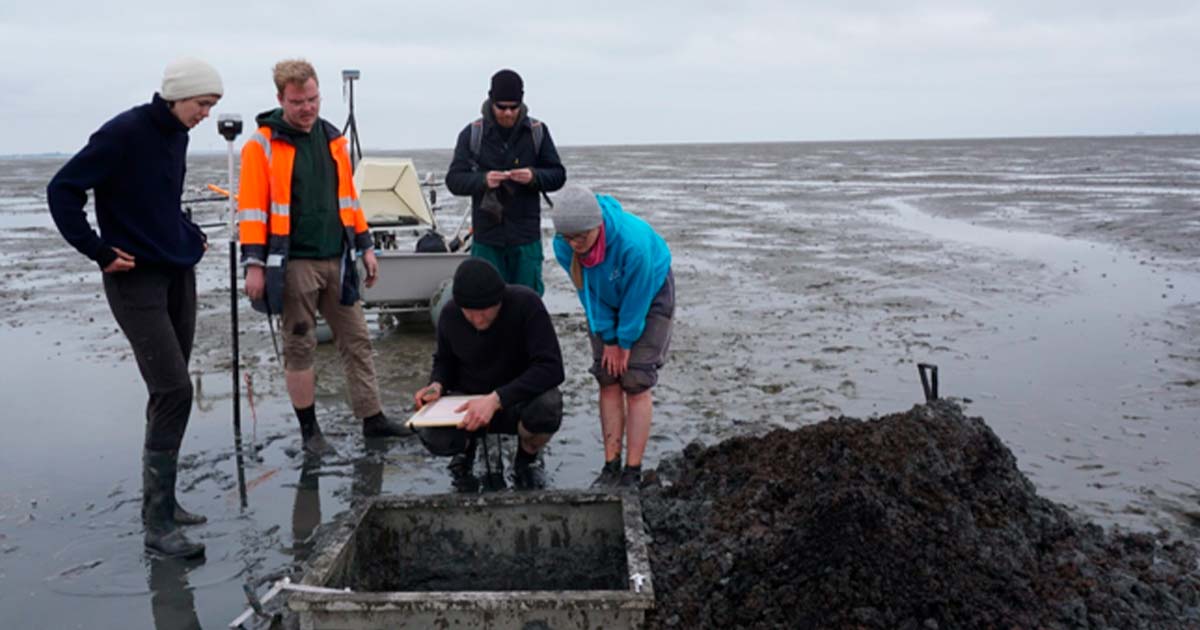
Top image: A special metal frame allows archaeological digs of one square meter in the area the Rungholt church has been detected on the tidal flats. Source: Universitaet Mainz
By Ashley Cowie
