


Inca Empire Constructed Over 40,000 Kms of Roads and Superhighways in 100 Years
The Inca Empire was a superpower that was centered on the western coast of South America. This prevailing civilization flourished between the 15th and 16th centuries, and at its height of power it extended from Quito, Ecuador, in the north, to Santiago, Chile in the south. The Inca Empire was the largest empire in the Americas, and one factor contributing to this was its complex road system, which is known as the royal highway, or qhapaq ñan.
The Vast Road Network
The roads of the Inca Empire have been estimated to cover a distance of over 40,000 km (24,854 miles), and can be found in modern countries that used to be part of this civilization, i.e. Ecuador, Peru, Bolivia, Chile, and Argentina.

Machu Picchu and mountains and Inca roads seen from Wayna Picchu ruins. (Armando Frazão /Adobe Stock)
There were two main highways that traversed the empire from the north to the south. One of these followed the coastline, while the other was located further inland, and passed through the highlands of the Andes. In addition to these, there were also secondary roads, as well as some smaller trails.
Some of these routes connected the two main highways, while others were built beyond the territories controlled by the empire. These could have served to facilitate trade with, or for the conduct of military campaigns against, neighboring peoples. Along some of the more important routes, milestones were placed to mark each Inca unit of distance, i.e. the topo, which is equivalent to 7 km (4.3 miles).
- New section of Inca road leading to Machu Picchu discovered
- Qhapaq Nan, the Grand Route of the Incas, wins World Heritage Status
- New Inca Ceremonial Complex Discovered in Peru May Contain Evidence of Human Sacrifice

This map shows the Inca Road System through South America. (CC BY-SA 4.0)
Adapting Ancient Connections
It should be mentioned that the Inca people did not build their entire road system from scratch. Some of these roads had been originally built by other cultures that once lived in areas conquered by the Inca, such as the Wari, the Tiwanaku, and the Chimu. Nevertheless, the engineers of the Inca Empire built upon these older roads and made further improvements to them.
In addition, the Inca culture began constructing new roads in more difficult terrains. Thus, the roads of the Incas were built across ravines, rivers, deserts, and mountain passes. The road through the Atacama Desert of Chile and one along the western margin of Lake Titicaca are two excellent examples of the achievement of the Inca road-builders.

Suspension bridge Q'eswachaca hanging over the Apurimac river, Quehue, Cusco, Peru. (Mark /Adobe Stock)
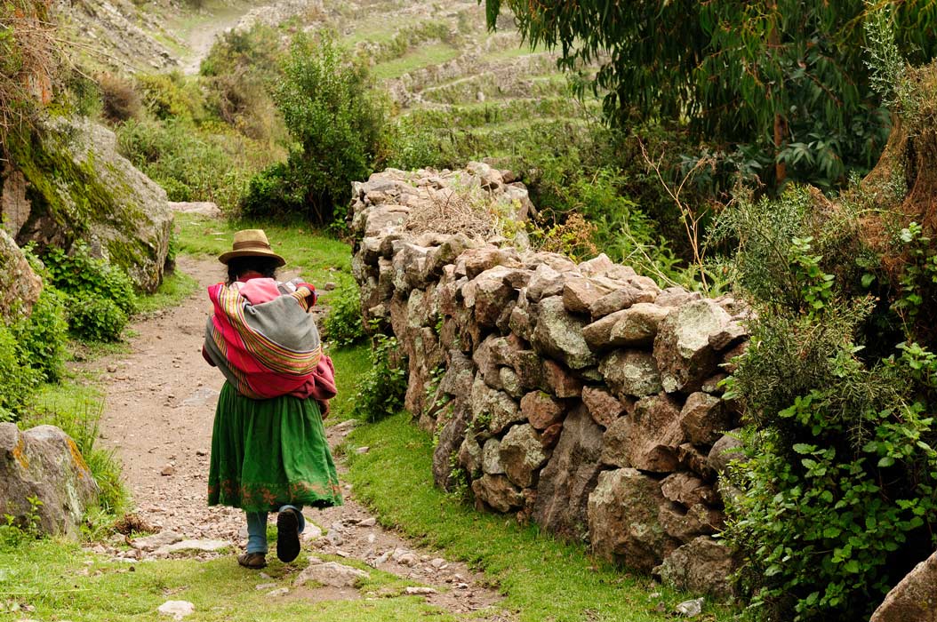
Resting in the Chaskiwasi and Tambos
In addition to roads, the Incas also placed small stations (known as chaskiwasi) along the routes. Sometimes, larger ones (known as tambos) were placed at a distance of about 20 km (12 miles) from each other, where travelers could rest on their journeys.
The roads were used primarily for official purposes of the state. For example, Incan armies used these roads to traverse the empire and maintain internal order, or to reach neighboring territories for the purpose of conquest. In addition, the roads served as trade routes, and tributes from conquered peoples were also conveyed along these roads to the major Incan centers. As the Inca culture did not have access to the wheel, these goods were transported on the backs of llamas or by porters.
The road system was also used by administrative officials, who traveled to the various parts of the empire on official business. This included the dispensation of justice and the maintenance of records. There were also runners along the roads, who would relay messages from one city to another.

Aerial view at Sacred Valley of Incas as seen from the hill at Pisaq near Cusco in Peru. (Marek /Adobe Stock)
These runners would be stationed at intervals of 6 -9 kilometers (3.73-5.59 miles), and it has been estimated that information could travel up to 240 km (149 miles) in a single day. Apart from messages, runners are also known to have transported perishable items, such as fresh fish from the coast, to the tables of the Inca nobility.
It may be pointed out that ordinary people needed to obtain official permission before they could use the roads for travelling. Additionally, there were tolls at certain points of the route, e.g. bridges, where they would need to pay a fee to cross.
- Tipón, Peru and The Hydro Engineering Marvel of the Inca
- The Ancient Ruins On and Beneath the Sacred Lake Titicaca
- Qhapaq Nan, the Grand Route of the Incas, expected to get World Heritage Status
Every year, rural Quechua communities in Peru carry out an ancient tradition that remembers the work of their ancient Inca ancestors by spending three days weaving the Q’eswachaka rope bridge to cross one of the many gaps in the Incan road system. The bridge is the last of its kind and then celebrating the completion of their work.
Built to Last
A large part of the Inca road system survives even today and 273 component sites have been given World Heritage status. The durability of the roads built by the Incas is evident when compared to those constructed in modern times. It has been reported that many modern roads are destroyed by water each year, while the Incan ones have survived for centuries.
Top Image: Peru, old Incan road in the canyon Cotahuasi. Source: Rafal Cichawa /Adobe Stock
By Ḏḥwty
References
Hirst, K. K., 2017. Inca Road System - 25,000 Miles of Road Connected the Inca Empire. [Online]
Available at: http://archaeology.about.com/od/iterms/qt/inca_road.htm
Jeremy Norman & Co., Inc., 2017. The Inca Road System. [Online]
Available at: http://www.historyofinformation.com/expanded.php?id=2639
O'Brien, J., 2015. Inca Road: The ancient highway that created an empire. [Online]
Available at: http://www.bbc.com/news/magazine-33291373
Staff writer, 2017. Inca Roads and Chasquis. [Online]
Available at: http://www.discover-peru.org/inca-roads-chasqui/
Symmes, P., 2015. What It's Like to Travel the Inca Road Today. [Online]
Available at: http://www.smithsonianmag.com/innovation/what-its-like-travel-inca-road-today-180955740/
UNESCO, 2017. Qhapaq Ñan, Andean Road System. [Online]
Available at: http://whc.unesco.org/en/list/1459

Comments
Oh, PS, I’m sure you are right that these paths go back way way further than the relatively modern Inca. They probably just made them much easier to traverse. Having walked a section, certain hairy points certainly benefitted form having a bit of stonework done!
Gary
Sorry I have only just come across this question, and hope you found the answer long ago. But just in case, if you click on the References heading at the end of the article, it will open the list of references for the article. I think you will find your answer in the first one listed. (25000 miles = 40,000km).
Gary
Your titlle states 40,000 KMs built in 100 years but was not mentioned in the article. What is your source for this and how was it validated? From what I have seen, things in South America are much older than what is being told. I am curious what evidence is being used and how for things like this.
Gleck