


UK’s ‘Oldest Map’ May Confirm the Location of the ‘Welsh Atlantis’
An 800-year-old medieval map of Great Britain kept in an Oxford library has been studied by two scientists and it clearly shows two islands lying off the Welsh coast, giving further momentum to the “Welsh Atlantis” theory.
Enshrined in legend for centuries, many tales and stories have been told about the mythical missing land lost beneath Cardigan Bay, Wales. The researchers suggest that one of the islands is situated between Aberystwyth and Aberdovey, with the other closer to Barmouth in the north, according to Great Britain’s “oldest map.”
This may be evidence of the legendary sunken kingdom of Cantre’r Gwaelod, said to be lost in the stages of post-glacial evolution. The two academics working on this study have suggested that the islands are likely remnants of a low-lying landscape underlain by soft glacial deposits. These deposits were likely laid down 10,000 years ago at the time of the last Ice Age but now lie beneath the sea and rivers.

The Gough Map from 1360 AD, shows two islands off Cardigan Bay, which may be part of the lost Welsh Atlantis. Note: North is left; east is up. (Bodleian Library, Oxford / Public Domain)
The Gough Map: Rising Seas Cover Welsh Atlantis?
The evidence, published in a study in the journal Atlantic Geoscience, which has incorporated literary evidence and folklore traditions with a hypothetical framework that incorporates the waning of the last Ice Age.
- Ice Age Galileans Thrived During Global Ice Melts
- Still Snarling After 40,000 Years, a Giant Pleistocene Wolf Discovered in Yakutia
According to the study authors this framework suggests that “during the Pleistocene, Irish Sea ice occupied the area from the north and west, and Welsh ice from the east… erosion proceeded along the lines of a template provided by a retreating shoreline affected by Holocene sea-level rise, shore-normal rivers, and surface run-off from the relict cliffline and interfluves… continued down-wearing, marginal erosion and marine inundation(s) removed the two remaining islands by the 16th century.”
This evidence has been presented by Simon Haslett, honorary professor of physical geography at Swansea University, who was looking for the lost islands in Cardigan Bay while he was a visiting fellow at Jesus College, Oxford. At Oxford he met David Willis, Jesus Professor of Celtic, who together studied the map in question known as the Gough Map, “the earliest surviving complete map of the British Isles.” The Gough Map is held in the Bodleian Library at Oxford University, reports The Independent.
"The Gough Map is extraordinarily accurate considering the surveying tools they would have had at their disposal at that time. The two islands are clearly marked and may corroborate contemporary accounts of a lost land mentioned in the Black Book of Carmarthen,” said Professor Haslett in an interview with the BBC. The Black Book of Carmarthen is a manuscript dating to 1250 AD, which is believed to be the main evidence of the Welsh Atlantis.
- Pleistocene Epoch: Humans, Welcome to Earth
- Study: How Pleistocene Hominins Crossed The Seas A Million Years Ago

Detail of the Gough Map showing Wales and the two “lost” islands of Cardigan Bay in the bottom-center of the image. (Image reproduced with permission of the Bodleian Library, Oxford: Oxford, Bodleian Library MS. Gough Gen. Top. 16 by Haslett, S. K., & Willis, D. / Atlantic Geoscience )
Disappearing Islands: Myth and Reality
The two scientists posit that the islands came into existence and disappeared again, particularly during rising sea levels in the Anthropocene. Some academics have suggested that the myths related to these islands originated in the “Old North,” in Scotland or Northumbria, travelling down to Wales later. In any case, Professor Haslett explains that the local folklore was rooted in historical and geographical realities.
During Roman cartographer Ptolemy’s time (100-170 AD), the Welsh coastline was somewhere around 13 kilometers (8 miles) further west than it is today. This would explain the evidence presented in the Gough Map for the two islands located in Cardigan Bay. Some of these folk legends say that long ago one could walk between these lands, a folk memory that stems from rising sea levels after the Pleistocene.
"However, legends of sudden inundation, such as in the case Cantre'r Gwaelod, might be more likely to be recalling sea floods and erosion, either by storms or tsunami, that may have forced the population to abandon living along such vulnerable coasts. In roughly a millennium, from Ptolemy's time to the building of Harlech Castle during the Norman period, the seascape had completely altered,” added Professor Haslett.
The castle built at Harlech, built clearly with the idea of having a “strategic advantage” overlooking the coastline, soon became landlocked. Additionally, the mass erosion of the islands released boulders that caused the accumulation of distinctive stone structures known as “sarns” in the vernacular. Putting it into context, this disappeared landscape likely existed 30 meters (98.4 feet) above current sea levels.
Professor Haslett concluded on a somber note, bringing together past and present, that, “Legends of sudden inundation, such as in the case of Cantre'r Gwaelod, might be more likely to be recalling sea floods and erosion, either by storms or tsunami, that may have forced the population to abandon living along such vulnerable coasts… These processes didn't happen just once, they're still on-going. With rising sea levels and more intense storms it's been suggested that people living around Cardigan Bay could become some of Britain's first climate change refugees, within our lifetimes.”
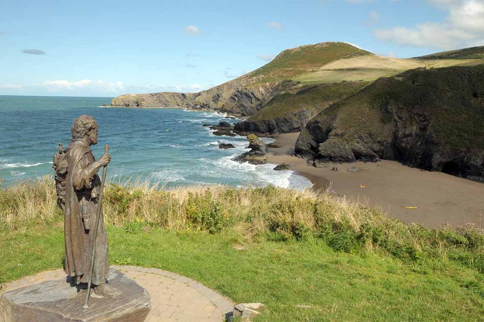
Top image: Statue overlooking Cardigan Bay, where the lost Welsh Atlantis may lay beneath the waves of today. Source: davidyoung11111 / Adobe Stock
By Sahir Pandey
References
CYMRU. 2022. Map showing islands off Cardigan Bay may be evidence of lost Cantre’r Gwaelod says Swansea academic. Available at: https://nation.cymru/news/cantrer-gwaelod/.
Davies, D. 2022. Medieval map sheds new light on legend of Cantre’r Gwaelod. Available at: https://www.cambrian-news.co.uk/news/medieval-map-sheds-new-light-on-legend-of-cantrer-gwaelod-560514.
Giddings, A. 2022. Is this a map of the ‘Welsh Atlantis’? Unearthed 13th century document shows two islands off coast of Wales that could be the lost kingdom of Cantre’r Gwaelod. Available at: https://www.dailymail.co.uk/news/article-11132099/Unearthed-Medieval-map-dating-13th-century-evidence-Welsh-Atlantis.html.
Gregory, A. 2022. Medieval map may show evidence of Wales’ Atlantis. Available at: https://www.independent.co.uk/news/uk/home-news/wales-atlantis-ceredigion-map-island-b2149622.html.
Haslett, S.K., Willis, D. 2022. The ‘lost’ islands of Cardigan Bay, Wales, UK: insights into the post-glacial evolution of some Celtic coasts of northwest Europe. Atlantic Geoscience, 58. Available at: https://doi.org/10.4138/atlgeo.2022.005.
Prior, N. 2022. Map may show evidence of Wales' Atlantis off Ceredigion. Available at: https://www.bbc.com/news/uk-wales-62605682.
Zeldon-O’Neill, S. 2022. Map may prove ‘Welsh Atlantis’ rooted in fact, say academics. Available at: https://www.theguardian.com/uk-news/2022/aug/21/gough-map-welsh-atlantis-academics-cardigan-bay.

Comments
So each culture that has a story legend or myth of the sea swallowing a civilization is its own Atlantis? XD ig it is human nature to associate new information by comparison with what one already knows
infinitesimal waveparticles comprise what we call home the earth
manipulatable by thought ability supressed in humans since birth