

A Possible Service Area on the Road to Mérida
Somewhere beneath the farmland at the edge of a Roman town in Andalusia, a row of rooms may once have put up travelers on the road between two Roman provincial capitals. Magnetic sensors have now sketched that building in sharp outline. So was this where Roman officials and soldiers stopped on their way through Mellaria?
According to a study by Miriam González Nieto in the Journal of Archaeological Science: Reports, the plan belongs to a roadside station, or mansio, on the edge of the Roman town of Mellaria, near Fuente Obejuna in Córdoba province. The University of Córdoba announced the find on October 22, 2026. Its Spanish-language release describes a building that would have worked as an "área de servicios" (Spanish for "service area"), where people traveling between Córdoba and Mérida could rest.
The paper's abstract describes "a previously undocumented infrastructure in the suburbium" of Mellaria, meaning the zone just outside the town. González Nieto, a DAAD postdoctoral fellow in ancient history at the University of Hamburg, worked with survey data gathered by a University of Córdoba team, and the result is a single long building lying parallel to the road.
Where Mellaria Stood
Mellaria sat on the road that linked Corduba, the modern city of Córdoba and capital of the province of Baetica, with Emerita, the modern city of Mérida and capital of Lusitania. The abstract calls the town "a key node along Route XI of the Antonine Itinerary", a Roman catalog of routes with their stops and distances (see also the new digital map of the Roman road network).
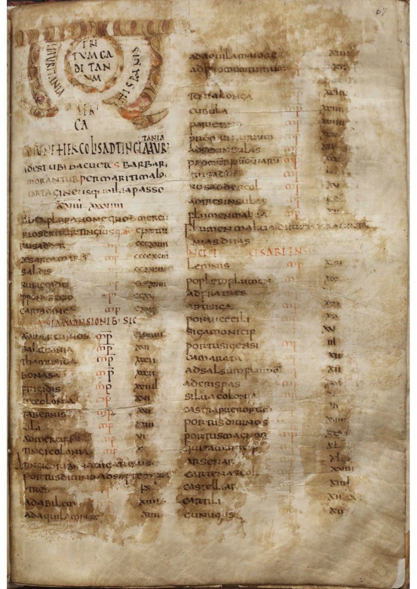
The first folio of the Antonine Itinerary in a manuscript held by the Royal Library of the Monastery of El Escorial, Spain (RBME R II 18). The itinerary lists Roman routes with their stopping places and distances. Image: Patrimonio Nacional, RBME R II 18, f. 67r, via Wikimedia Commons, licensed under Creative Commons Attribution 4.0 International (CC BY 4.0)
As La Brújula Verde reports from the study, the itinerary places Mellaria 52 Roman miles from Corduba, roughly 77 kilometers, and the newly mapped building lies at that point on the route. The same report says the town began as a military fort in the middle of the 2nd century BC and later became a self-governing municipium under the Flavian emperors.
The University of Córdoba release says Mellaria was for years the center of mining, industrial and farming activity in its district. For that reason the university's HUM 1150 Unidad Patricia research group has studied the site for several years through its Ager Mellariensis project. Its geomagnetic survey ran between 2021 and 2023.
Mapping Walls Without a Trench
The team used geomagnetic survey, which records tiny changes in the magnetism of the ground caused by buried walls, ditches and burned areas. Archaeology News Online Magazine reports that the crew pulled a cart fitted with four fluxgate gradiometers across the fields. A satellite positioning receiver fixed the location of each reading.
The abstract states that "the complete ground plan of a longitudinally arranged building has been recovered with exceptional clarity." La Brújula Verde, summarizing the paper, adds that gentle terrain and the absence of modern metal nearby helped produce a plan of unusual sharpness.
That method matters because roadside stations are hard to find. In the abstract's words, their "archaeological identification remains a challenge due to the scarcity of visible surface remains." According to La Brújula Verde, the study cites two well-documented road stops in Hispania. They are the relay post, or mutatio, of Mariturri in Vitoria and Miaccum in the Guadarrama mountains near Madrid.
The survey result itself is Established, since both the paper and the university describe the same mapped building. The release gives its length as 48 meters and its total area as about 1,290 square meters, placed outside the urban core of Mellaria and right next to the Roman road, in the same area that the Roman itineraries described.
Eight Rooms, a Bath and a Yard
The university's reading of the plan is specific. The release says the building would have had eight rooms, a bath and a large yard that can be interpreted as a stable or a parking area for carriages, where draft animals could rest. Archaeology News Online Magazine reports that the small rooms measure roughly 3.6 by 4 meters each.
A long room at the western end, about 44.8 square meters in area by the same report, resembles the bath block at Rottweil in Germany. Behind the rooms lies an open space about 11 meters wide with no walls, which González Nieto reads as a yard for animals and vehicles, as both news reports summarize the paper.
These room functions are Unverified for now, since a magnetic map shows where walls stand but cannot by itself show whether a long room held hot pools or an open area held horses. La Brújula Verde notes that the identification rests on the geophysical plan and on comparison with other buildings, and that the author defends that approach where digging is not possible.
Why a Standard Mansio?
Roman travel on official business ran through the cursus publicus, the state transport and courier system. Its network had two kinds of stops, as La Brújula Verde explains from the study. Small mutationes were places to change animals, while larger mansiones offered beds and supplies to officials, soldiers and couriers at intervals of roughly a day's journey.
The abstract classes the Mellaria building "within the standard class of Roman mansiones", with "a modular, repetitive layout identical to well-known continental parallels such as Vindonissa (Switzerland) and Rottweil (Germany)." The university release adds that standard stations followed the model of a military barracks and served ordinary travelers, troops and service staff.
Elite stations looked different, according to La Brújula Verde. First-class mansiones, meant for emperors and dignitaries, stood a little away from the road around a central courtyard, often with wall paintings, mosaics and underfloor heating. The Mellaria plan shows rows of identical rooms, close in size to barracks rooms at Carnuntum in the Roman province of Pannonia.
Location supports the same reading, and the release explains that a station on the outskirts beside the road let travelers stop, restock and change horses quickly, without bringing heavy traffic, carriages and animals into the town itself. At about 1,290 square meters, the building falls near the upper end of the usual range for such main buildings, according to La Brújula Verde.
How Far Does the Evidence Go?
Taken together, the evidence for a mansio is circumstantial. The plan, the position on the road and the distance in the itinerary all point the same way. Yet no excavation has recovered pottery, coins or inscriptions, and neither the abstract nor the release gives a date for when the building stood or how long it was used.
That leaves the identification of the building as a mansio Unverified, though it is a reasonable reading of good survey data. The wider claims are less secure still. The release says magnetic anomalies around the building suggest that the complex extended further, and it places a first-class building about 50 meters to the north, connected with the first.
The abstract also says the size of the complex points to a role "likely connected to the management of road traffic and possibly to the storage and redistribution of goods." Those functions, like the second building to the north, remain Unverified until someone digs. Only excavation can show what the rooms and any storerooms around them actually held.
For now, the Mellaria building is known only as an outline on a magnetic map. Archaeology News Online Magazine notes that few stations along Spanish roads have been securely identified, and that farmland and modern building hide most of them.
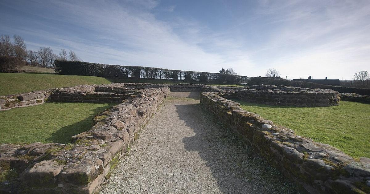
For comparison only: remains of the Roman mansio at Letocetum in Staffordshire, England, photographed on February 24, 2011. This is a different site in England, not Mellaria, where the building has been mapped but not excavated. Photo: Bs0u10e01 (own work), via Wikimedia Commons, licensed under Creative Commons Attribution 3.0 Unported (CC BY 3.0)
By Aris Manus
Sources
- Miriam González Nieto, "On the archaeological evidence of mansiones along the Roman roads of Hispania in the Antonine Itinerary: The case of Mellaria (Fuente Obejuna, Córdoba, Spain)," Journal of Archaeological Science: Reports 75, 2026, 106073
- University of Córdoba (UCC+i), "Identifican un 'área de servicios' romana en Fuente Obejuna," Actualidad Universitaria, October 22, 2026 (in Spanish)
- Guillermo Carvajal, "A Roman 'Highway Rest Stop' With Barracks-Style Rooms and a Bathhouse Found in Southern Spain," La Brújula Verde, October 23, 2026
- Dario Radley, "Magnetic scans reveal a Roman roadside station near Fuente Obejuna in southern Spain," Archaeology News Online Magazine, October 24, 2026
- Bs0u10e01, "File:Mansio Letocetum.jpg," Wikimedia Commons, February 24, 2011, CC BY 3.0
- Patrimonio Nacional, "File:RBME R II 18 f.67r Itinerarium Antonini Augusti.png," Wikimedia Commons, CC BY 4.0