


Britain’s “Best Preserved Pictish Homes” Studied in Caithness
Ancient dwellings in the far north of Scotland, called “wags”, are thought to be the best preserved Pictish homes in Britain.
While to many the term ‘Wags’ refers to footballers’ “wives and girlfriends” but this is not the case in the far north of Scotland where a ‘Wag’ is a stone built longhouse occupied by the Picts of modern-day Scotland from about 1,400 years ago. And one particular ancient settlement known as ‘Wag of Forse’ is located just south of Wick, in Caithness, my home town in the north east coast of Scotland, and Picts lived at this remote location from the late Iron Age until it was abandoned in the early Medieval period.

Hand-colored version of Theodor de Bry’s engraving of a Pict woman (a member of an ancient Celtic people from Scotland). De Bry’s engraving, “The True Picture of a Women Picte,” 1588 (Public Domain)
Who Were The Picts?
The Picts were a confederation of Celtic language-speaking peoples who lived in what is today eastern and northern Scotland during the Late British Iron Age and Early Medieval periods and their culture is inferred from early medieval texts and the symbols found on carved Pictish stones. And never before has so much time and money been spilled into research on the Picts, evident in that only in August I wrote an Ancient Origins news piece about archaeologist Anne MacInnes from the North of Scotland Archaeological Society who while surveying the grounds of an early Christian church in Dingwall, about 100 miles south of Wag of Forse, discovered a rare Pictish symbol stone.
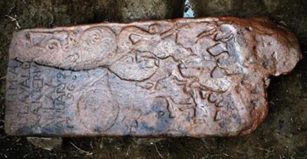
The Pictish stone found in Dingwall was reused as a horizonal grave slab in the 1790s - hence the inscription in the corner. Source: NOSAS
The settlement in Caithness includes a range of reused buildings including an Iron Age Broch, which is a vast circular defensive stone tower used for drying grain. According to the BBC, The Northern Picts Project is conducted by the University of Aberdeen and their recent investigations at Wag of Forse were conducted with help from Caithness Archaeological Trust and the Dunbeath Heritage Museum, which aimed to “recover materials left behind from previous archaeological digs in the 1930s and 40s.” And a paper written in 1947 by archaeologist Alexander Curls presents evidence for “pre-Wag of Forse wag occupation” at Forse, and at nearby contemporary sites.
- Why Would You Cremate and Bury Your Home? A Bizarre Viking Ritual Explained
- Does the Fierce Reputation of The Picts Reflect Reality?
- Picking Apart the Picts: The Value of Aberdeen's Newest Discovery

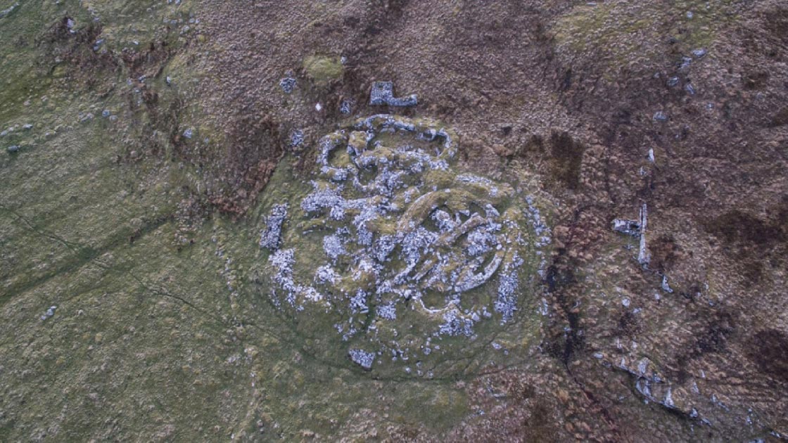
Wag of Forse includes stone structures, chambers, tunnels and steps. Image: Bill Fernie
A 1400-year-old Pillar Still Stands
According to RCAHMS: Exploring Scotland's Heritage - The Highlands, 1995 a 'Wag' is the local name deriving from Gaelic word meaning 'little cave’, and the great spread of stones that is ‘Forse Wag’ were partially “and rather clumsily” excavated between 1939 and 1948. And while this settlement began as a group of ancient stone huts they were later been replaced by a vast circular broch which was itself dismantled to build a series of pillared houses.
A second longhouse to the west of the broch at the Forse settlement measures 12 meters (40ft) long and has the remains of two rows of upright, pillar-like stones, which once supported a roof and a long entrance passage with door checks and passages leading into other rooms, one of which is round with a stone pillar still standing after 1400 years.

This vertical pillar at Wag of Force is still in its original position after 1400 years. (Image: Iain Maclean, Caithness Broch Project).
But with all that is known about this site “it's probably a bit early to be labeling” it Pictish, says Mr Iain Maclean, founder of the Caithness Broch Project. Iain suggests accurate “carbon data” has yet to be found to draw a complete picture of the site, but if it proves to have had a Pictish occupation phase then it's certainly one of the most extensive sites that have been previously excavated in Caithness. And, furthermore, Mr Maclean said in an email to Ancient Origins that with “so many other” unexcavated sites still to be investigated it's possible there's “much more” to be revealed in the county.
Reading Pictish Landscapes
To obtain a richer perspective of how the Picts lived in these testing northern landscapes we must move outwards from the wags and the broch and consider what lies in the surrounding field. At the Forse settlement ancient hut circles are to be found to the west while to the south a green mound located on an old stream bed conceals three burnt mounds. What’s more, to the northeast, according to the 1995 book, Exploring Scotland’s Heritage: The Highlands, a large grassy mound in the distance is another “unexcavated Pictish Broch.”
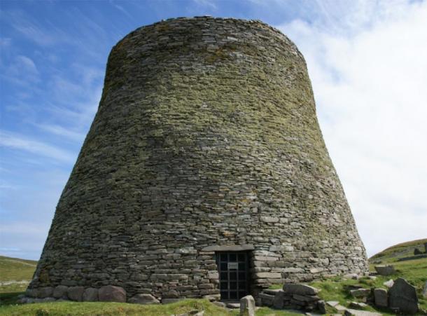
Mousa Broch, Shetland, Scotland. (CC BY-SA 3.0)
With almost 200 ruined broch sites in Caithness there is a general consensus that Wag of Force is “one of the best” and according to Iain Maclean its complexity results from the sites reuse over time, and he said that there is still “so much yet to be learned by its re-investigation.” The recent resurgence of interest in these enigmatic structures has seen the Caithness Broch Project working closely with Historic Environment Scotland who have permitted and funded the conservation of several broch sites in Caithness. However, it would be wrong to interpret the Wag of Forse as a stand-alone settlement, for according to Mr Maclean two more brochs are located within a mile of Wag of Forse.
Aligned For Defense?
In many areas of Scotland, brochs are often situated with close proximity of each other suggesting that they may have had primarily defensive or even offensive functions, further indicated by so many of these ancient buildings having been situated beside precipitous cliffs and protected by large ramparts. In scholar John Stewart’s 1956 book An Outline of Shetland Archaeology he explained that Brochs were “forts put up by a military society to scan and protect the countryside and seas” and because you can often sight one broch from another it is thought possible that some groups had served as part of a ‘signaling network’.
Testing such theories about how Picts might have defended their rich agricultural territories, in 2017, I teamed up with Iain Maclean to film short documentary exploring ‘broch alignments’ and how these ancient structures might have been strategically located within environments so that entire regions could be alerted with flags or smoke when under attack.
On the east coast of Caithness less than ten miles from Forse we plotted a string of four brochs leading from the North Sea some five miles inland up the Berridale strath, all located within line of sight of each other, which can be plotted on www.pastmap.com. But while Mr Maclean considers this idea ‘feasible’, he says much more work must be carried out to see if these groups were contemporaneous and part of a greater communication system, or not.
Top image: Forse Wag drone photograph showing extent of the ancient site Wag of Forse. Source: Iain Maclean, Caithness Broch Project
By Ashley Cowie
