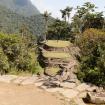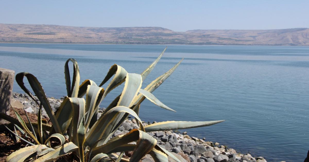


Part of the port that once connected the biblical town Capernaum to the lake, including a pyramid-shaped stone that served as an entrance marker to guide boats in safely. (Christian Media Center)
Stone Moorings Reappear at Capernaum Port
This structure is made up of two lines of large stones located around three to four meters apart. To elaborate on this, Hagay Dvir who is tourism manager for Israel Nature and Parks Authority states that these two lines of rocks made a safe docking area where two boats can dock. The stone structure which is in the shape of a pyramid is located at the end of the dock and is assumed to be a guiding stone marker for the navigation of the boats toward the port. This type of segmented docking area differs in design from the continuous platforms familiar at many modern marinas.
Dvir argued in the Christian Media Center’s original coverage that the location makes it feasible to talk about Jesus’ "maritime activity on the Sea of Galilee, and not only His works on land.”
The Israel Nature and Parks Authority presents Capernaum as a fishing village situated on the northwestern shore of the lake which played a crucial role for Jesus during his mission in Galilee while some of his disciples were working as fishermen. So, it is reasonable to assume that the harbor is very referential, but this cannot be misinterpreted as conclusive evidence supporting the claim that Jesus had visited this particular pier.
- Ancient City of Bethsaida - Supposed Home of Jesus and the Apostles - Discovered in Golan
- Ancient Greek Inscription in Mosaic Reveals Birthplace of Apostle Saint Peter!
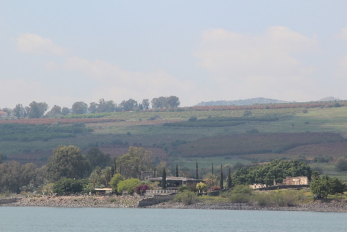
The archaeological site of Capernaum viewed from the Sea of Galilee. (Fallaner/CC BY-SA 4.0)
A New Exposure, Not an Unknown Harbour
Despite some headlines hinting at a newly discovered miracle site, archaeologists were not unaware of the Capernaum port. The primary report states that lower water revealed a pier mapped decades ago by Mendel Nun, the fisherman-scholar who surveyed the lake’s ancient waterfront. Gordon Franz’s history of Sea of Galilee harbors credits Nun with identifying 16 harbors and anchorages around the lake. Changing shorelines have repeatedly aided research here, from other submerged structures in the Sea of Galilee to finds around Magdala.
Changing shorelines have repeatedly aided research, from other submerged structures in the Sea of Galilee to finds around Magdala.
- Has the lost Biblical town of Dalmanutha been found?
- Archaeologists Excavate Possible Home of Mary Magdalene and Synagogue Where Jesus May Have Preached
Determining the dating of the harbor constructions is a more complex process than the simple expression of the channel being “two thousand years old”. In the archaeological research of Capernaum, Matthew J. Grey points out that some scholars believe the extant construction to belong to the early period of the first century, while some suggest that most of the construction activities took place in the course of expansion in the second or third century. The smaller basalt jetties might have been used before by the fishermen community, the number of the members of which, according to Grey, was around 1000 to 1500 people.
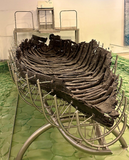
The Ancient Galilee Boat, an approximately 2,000-year-old vessel found near Ginosar in 1986. (Warfieldian/CC BY-SA 4.0)
What the Stones Can—and Cannot—Tell Us
The most telling evidence for the boats using the harbor is the Ancient Galilee Boat which was found near Ginosar in 1986 during a drought. This surviving vessel measures 8 meters long and has been dated to approximately 2000 years ago. It is not the boat used by Jesus, but its size and sail and row numbers give us an understanding of the boats used for transporting fishing crews and passengers from Capernaum, and Magdala to Bethsaida-Julias. All of these findings give evidence of an active shore life rather than an isolated biblical location.
According to the Gospel of John 6:16-24, the disciples began their journey to Capernaum before seeing Jesus approach at their ship in rough seas. The gospel does not specify where the journey started or where the ship landed but the importance of the Capernaum port lies, thus, in its archaeologically and contextually substantiated status of a socially active port city on the shores of the Sea of Galilee, a place where several of Jesus’ miracles were performed according to the Bible.
Top image: The Sea of Galilee seen from Capernaum. Source: Eduard Marmet/CC BY-SA 2.0
By Gary Manners
References
Christian Media Center. 2025. Discovery of the Port of Capernaum: In the Footsteps of Christ. Available at: https://cmc-terrasanta.com/en/media/news/38493/discovery-of-the-port-of-capernaum:-in-the-footsteps-of-christ
Franz, G. 2014. Ancient Harbors of the Sea of Galilee. Available at: https://biblearchaeology.org/research-articles/ancient-harbors-of-the-sea-of-galilee/
Grey, M. J. 2014. Simon Peter in Capernaum: An Archaeological Survey of the First-Century Village. Religious Studies Center, Brigham Young University. Available at: https://rsc.byu.edu/ministry-peter-chief-apostle/simon-peter-capernaum-archaeological-survey-first-century-village
Israel Nature and Parks Authority. n.d. Kfar Nahum (Capernaum ) National Park. Available at: https://en.parks.org.il/reserve-park/kfar-nahum-capernaum-national-park/
Liberatore, S. 2026. Site where the Bible says Jesus walked on water discovered after 2,000 years. Available at: https://www.dailymail.com/sciencetech/article-16099817/jesus-miracle-site-sea-galilee-discovery.html
Oremus Bible Browser. 2021. John 6:16–27. Available at: http://bible.oremus.org/?passage=John+6:16-27
Yigal Allon Centre. n.d. The Ancient Boat. Available at: https://yigal-allon-centre.org.il/en/the-museum/the-ancient-boat/