

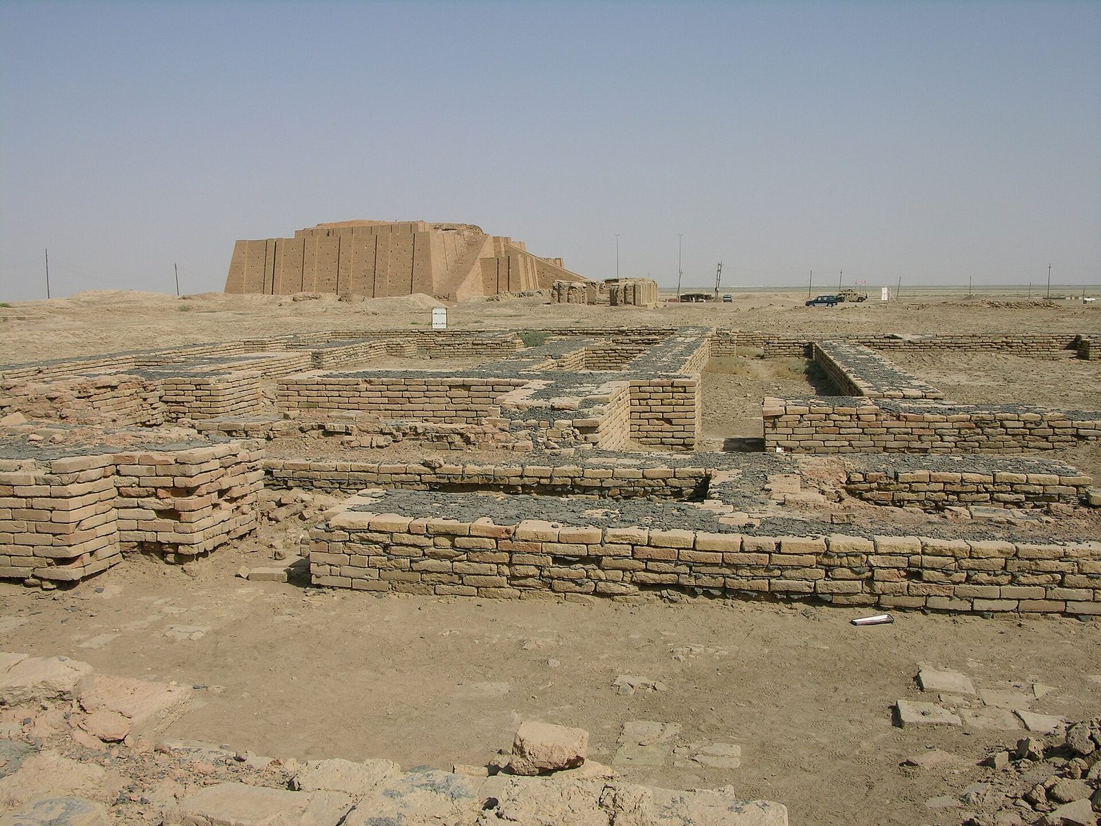
Photo: M.Lubinski from Iraq,USA., CC BY-SA 2.0 via Wikimedia Commons Source
A major Sumerian city with a great ziggurat and the Royal Tombs excavated by Leonard Woolley. It dates from 3800 BC and is associated with the ancient Near East and the Sumerians. It is part of a UNESCO World Heritage Site.
- Country
- Iraq
- Region
- Asia
- Period
- about 3800 to 500 BC
- Kind of site
- Ancient city, archaeological site
- Dates from
- 3800 BC
- Period or culture
- ancient Near East, Sumerians, Old Babylonian Period
- Heritage status
- Part of UNESCO World Heritage Site
- Part of
- Ahwar of Southern Iraq
- Located in
- Dhi Qar Governorate, Iraq
- Also known as
- Tell al-Muqayyar
- Coordinates
- 30.9617° N, 46.1051° EWikipedia and Wikidata agree within 0.09 km
- Reference
- Wikidata Q5699
- Encyclopedia
- Wikipedia article
About this place
Ur was a major Sumerian city-state in ancient Mesopotamia, located at the site of modern Tell el-Muqayyar (Arabic: تَلّ ٱلْمُقَيَّر, lit. 'mound of bitumen') in Dhi Qar Governorate, Iraq. Although Ur was a coastal city near the mouth of the Euphrates on the Persian Gulf, the coastline has shifted and the site is now well inland, on the south bank of the Euphrates, 16 km (10 mi) southwest of the city of Nasiriyah. The city dates from the Ubaid period c. 3800 BC, and is recorded in written history as a city-state from the 26th century BC, its first recorded king being Mesannepada. The city's patron deity was the moon god Nanna (Sin in Akkadian), and the name of the city is derived from UNUGKI, literally "the abode (of Nanna)".
Adapted from the Wikipedia article Ur (this version), lightly edited for style, under the CC BY-SA 4.0 license.
Nearby places
Open in the Atlas →- Tell al-'Ubaid 7.2 km (4.5 mi)
- Eridu 19 km (12 mi)
- Tell Khaiber 20 km (12 mi)
- Kuara 26 km (16 mi)
- Tell Dehaila 30 km (19 mi)
- Tell el-'Oueili 38 km (23 mi)




Recent comments