

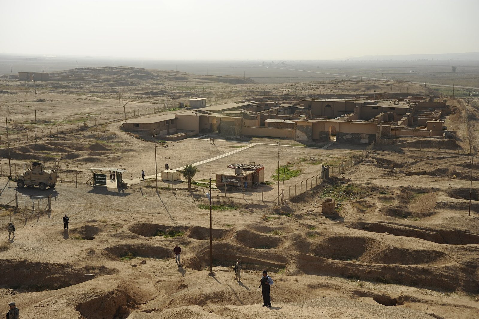
Photo: Staff Sgt. JoAnn Makinano, Public domain via Wikimedia Commons Source
An Assyrian royal city with palaces and lamassu, heavily damaged in 2015. It dates from the 13th century BC and is associated with the Assyrian Empire. It is on the UNESCO World Heritage Tentative List.
- Country
- Iraq
- Region
- Asia
- Period
- 9th to 7th century BC
- Kind of site
- Ancient city, archaeological site
- Dates from
- 13th century BC
- Period or culture
- Assyrian Empire
- Heritage status
- Tentative World Heritage Site
- Located in
- Nineveh Governorate, Iraq
- Also known as
- Calah; Kalhu; Kalakh; Kalkhu
- Coordinates
- 36.0981° N, 43.3289° EWikipedia and Wikidata agree within 0.0 km
- Reference
- Wikidata Q237614
- Encyclopedia
- Wikipedia article
About this place
Nimrud is an ancient Assyrian city located in Iraq, 30 kilometers south of the city of Mosul, and 5 kilometers south of the village of Selamiyah, in the Nineveh Plains in Upper Mesopotamia. It was a major Assyrian city between approximately 1350 BC and 610 BC. The city is located in a strategic position 10 kilometers (6 mi) north of where the river Tigris meets its tributary the Great Zab. The city covered an area of 360 hectares (890 acres). The ruins of the city were found within one kilometer (1,100 yd) of the modern-day Assyrian village of Noomanea in Nineveh Governorate, Iraq. By 800 BCE, the city of Nimrud had expanded to a population of approximately 75,000, establishing it as the most populous urban center in the world at that time.
Adapted from the Wikipedia article Nimrud (this version), lightly edited for style, under the CC BY-SA 4.0 license.






Recent comments