

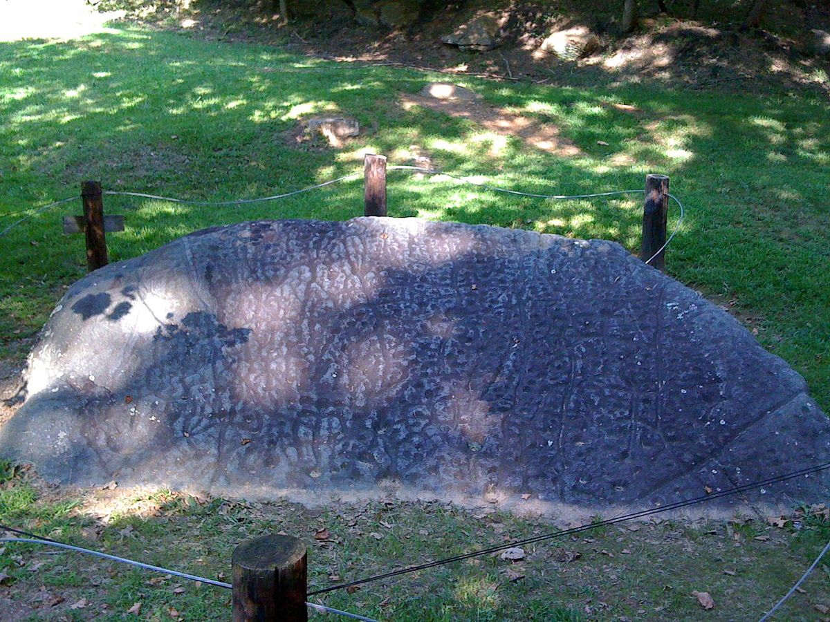
Photo: Spjctim, Public domain via Wikimedia Commons Source
Judaculla Rock is an archaeological site in Jackson County, United States of America. It is listed on the National Register of Historic Places.
- Country
- United States
- Region
- Americas
- Period
- Pre-Columbian era
- Kind of site
- Archaeological site
- Heritage status
- National Register of Historic Places listed place
- Located in
- Jackson County, United States
- Coordinates
- 35.3010° N, 83.1099° WCoordinates from Wikidata
- Reference
- Wikidata Q6302064
- Encyclopedia
- Wikipedia article
About this place
Judaculla Rock is a curvilinear-shaped outcrop of soapstone known for its ancient carvings and petroglyphs. The archaeological site is located on a 0.85-acre rectangular-shaped property, now owned by Jackson County. It is approximately 60 meters east of Caney Fork Creek, a major branch of the northwestward-trending Tuckasegee River in the mountains of Western North Carolina. The petroglyph boulder occurs within a man-made bowl-shaped depression. Today the land is covered with mowed turf grass (previously, it was cultivated as a cornfield) and bordered on the west by a thicket of rivercane (Arundinaria gigantea). Slightly upslope and east of the boulder are a few smaller outcroppings of soapstone bedrock, at least two of which show definite scars left by ancient quarrying for soapstone bowl manufacture.
Adapted from the Wikipedia article Judaculla Rock (this version), lightly edited for style, under the CC BY-SA 4.0 license.
Nearby places
Open in the Atlas →- Nikwasi 27 km (17 mi)
- Oconaluftee Archeological District 30 km (18 mi)
- Kituwa 33 km (20 mi)
- Garden Creek site 34 km (21 mi)
- Robinson Rock House Ruin and Plantation Site 36 km (22 mi)
- Keowee 53 km (33 mi)
Place data from Wikidata (CC0). Ancient Origins has not yet reviewed this entry in depth.




Recent comments