

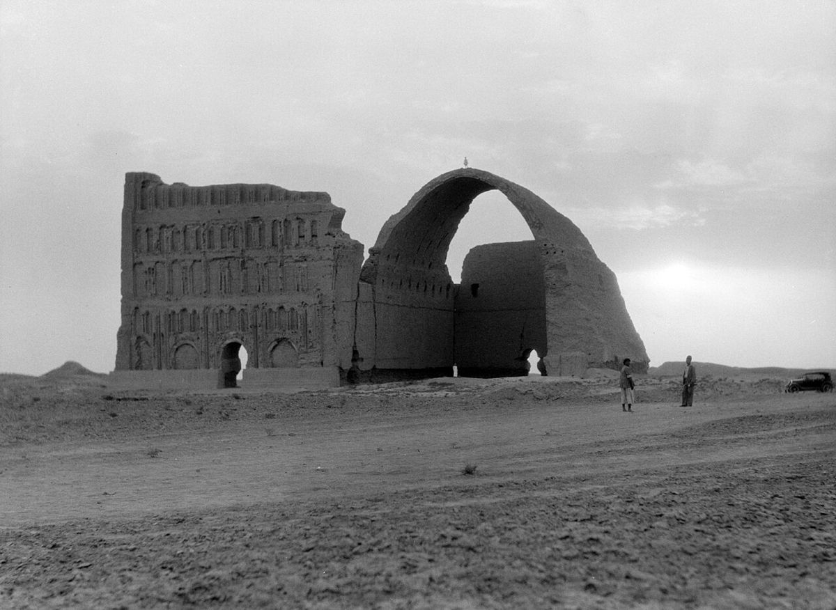
Photo: Unknown authorUnknown author (American Colony Photo Department), Public domain via Wikimedia Commons Source
Ctesiphon is a capital of the Iranian empire in the Parthian and Sasanian eras in present Iraq. It dates from the 120s BC and is associated with Greater Iran. It is part of Seleucia-Ctesiphon.
- Country
- Iraq
- Region
- Asia
- Period
- 120 BC to AD 637
- Kind of site
- Ancient city, archaeological site
- Dates from
- 120s BC
- Period or culture
- Greater Iran
- Part of
- Seleucia-Ctesiphon
- Located in
- Asuristan, Iraq
- Also known as
- Al-Mada'in; Mahoze; Mahuza; Mint of Ctesiphon
- Coordinates
- 33.0936° N, 44.5808° ECoordinates from Wikidata
- Reference
- Wikidata Q192541
- Encyclopedia
- Wikipedia article
About this place
Ctesiphon was an ancient city in modern Iraq, on the eastern bank of the Tigris, about 35 kilometers southeast of Baghdad. Ctesiphon served as a royal capital of the Iranian empires for over eight hundred years, in the Parthian and Sasanian periods. It fell in 637, during the Muslim conquest of Persia. Ctesiphon developed into a rich commercial metropolis, merging with the surrounding cities along both shores of the river, including the Hellenistic city of Seleucia. Ctesiphon and its environs were therefore sometimes referred to as "The Cities" (Mahuza, Arabic: المدائن, romanized: al-Mada'in). In the late 6th and early 7th century, it was listed as the largest city in the world by some accounts. During the Roman-Parthian Wars, Ctesiphon fell three times to the Romans, and later fell once during Sasanian rule.
Adapted from the Wikipedia article Ctesiphon (this version), lightly edited for style, under the CC BY-SA 4.0 license.
Nearby places
Open in the Atlas →- Seleucia 5.7 km (3.5 mi)
- Opis 15 km (9 mi)
- Tell Ishchali 23 km (14 mi)
- Diniktum 24 km (15 mi)
- Tell Muhammad 25 km (16 mi)
- Tell al-Dhiba'i 26 km (16 mi)
Place data from Wikidata (CC0). Ancient Origins has not yet reviewed this entry in depth.



Recent comments