

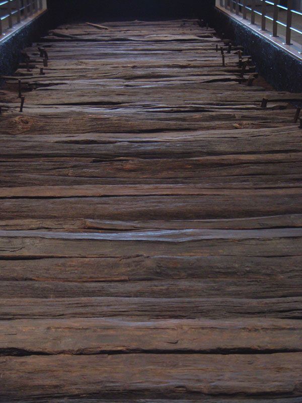
Photo: milezero, CC BY-SA 2.0 via Wikimedia Commons Source
Corlea Trackway is an Iron Age trackway.
- Country
- Ireland
- Region
- Europe
- Period
- Iron Age
- Kind of site
- Archaeological site
- Coordinates
- 53.6268° N, 7.8534° WCoordinates from Wikidata
- Reference
- Wikidata Q340086
- Encyclopedia
- Wikipedia article
About this place
The Corlea Trackway is an Iron Age trackway, or togher, near the village of Keenagh, south of Longford, County Longford, in Ireland. It was known locally as the Danes' Road. It was constructed from oak planks in 148 to 147 BC, making it contemporary with the Siege of Carthage. The trackway is situated in an area which is the site of industrial-scale mechanised peat harvesting by the Bord na Móna, principally to supply the peat-fired power stations of the Electricity Supply Board. While today a generally flat and open landscape, in the Iron Age it was covered by bog, quicksand, and ponds, surround by dense woodlands of birch, willow, hazel and alder while higher ground was covered by oak and ash. The terrain was dangerous and impassible for much of the year.
Adapted from the Wikipedia article Corlea Trackway (this version), lightly edited for style, under the CC BY-SA 4.0 license.
Nearby places
Open in the Atlas →- Inchbofin Ecclesiastical Site 10 km (6 mi)
- Rindoon 14 km (8 mi)
- Abbeyshrule Monastery 14 km (9 mi)
- Dunnamona 15 km (9 mi)
- Knockanyconor portal tomb 16 km (10 mi)
- Scregg Tomb 19 km (12 mi)
Place data from Wikidata (CC0). Ancient Origins has not yet reviewed this entry in depth.







Recent comments